When people ask what an Everest helicopter tour actually looks like, the honest answer is that no photograph fully prepares you. Here is every significant landmark you pass on the route from Kathmandu to Everest Base Camp, describes what each one looks like from the air, and explains why knowing what you are looking at makes the experience significantly richer.
The Flight Path: Kathmandu to Everest Base Camp
The helicopter departs from either the Tribhuvan International Airport domestic terminal or the Shyambhu helipad in Kathmandu, both at roughly 1,300 metres above sea level. The flight to Everest Base Camp covers approximately 140 kilometres in a straight line, climbing continuously as it travels northeast toward the Khumbu region. Total flight time one way runs between 45 minutes and 1 hour depending on conditions and the specific departure point.
The route takes you over the Kathmandu Valley rim almost immediately, then across the Middle Hills zone of central Nepal, into the Solu Khumbu district, and finally up the Khumbu Valley to base camp. Each phase of the flight reveals a different layer of the Himalayan landscape.
Leaving Kathmandu: The Valley Rim and the First Hills
In the first ten minutes after takeoff, the helicopter crosses the ridgeline that forms the northern edge of the Kathmandu Valley. Below you, the city gives way quickly to terraced hillsides. These are not dramatic Himalayan peaks, they are the middle hills of Nepal, mostly between 1,500 and 2,500 metres, covered in a mix of agricultural terracing, pine forest, and scattered village settlements.
What catches most passengers off guard in this early phase is how abruptly the scale changes. Kathmandu feels like a large city until you are above it, at which point you realize it fits comfortably inside a single valley bowl. Within minutes the city disappears behind the first ridge and you are flying over rural Nepal.
Namche Bazaar from the Air
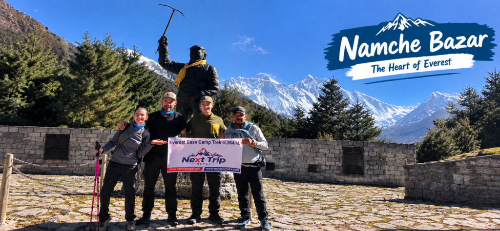
Roughly 35 to 40 minutes into the flight, the helicopter enters the Sagarmatha National Park zone and Namche Bazaar comes into view. Namche sits at 3,440 metres in a natural amphitheater carved into the hillside above the junction of the Bhote Koshi and Dudh Koshi rivers. From the air, the semi-circular arrangement of the town is immediately obvious in a way it never is on foot.
Namche is the main trading hub and acclimatization stop for EBC trekkers, who typically spend at least two nights here. From the helicopter you pass it in seconds, but the view looking down into the bowl of the town, with the river gorge below and the ridge of Kongde Ri (6,187 metres) rising behind it, is one of the cleaner aerial compositions of the entire flight.
Tengboche Monastery
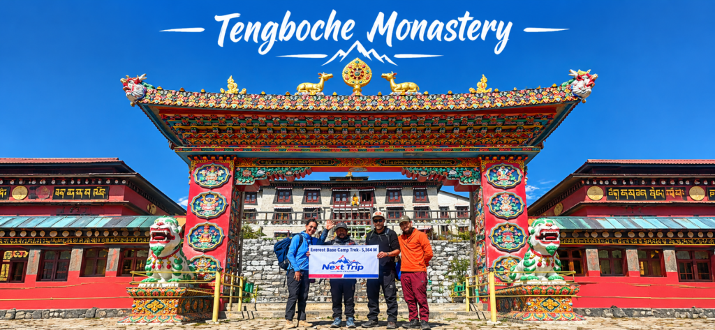
Further up the valley, at 3,867 metres on a ridge between the Imja Khola and Dudh Koshi rivers, sits Tengboche Monastery. It is the most important Buddhist monastery in the Khumbu region and one of the most photographed buildings in Nepal. The main gompa, rebuilt after a fire in 1989, sits at the crest of a ridge with Ama Dablam behind it and Everest, Lhotse, and Nuptse visible further back on a clear day.
From the helicopter, Tengboche appears as a cluster of white and ochre buildings on a rounded ridge. The context the flight provides is remarkable: you see exactly how the monastery sits at the intersection of three valleys, how exposed the ridge is, and how the arrangement of peaks behind it creates the composition that made the site famous.
Ama Dablam: The Mountain That Defines the Khumbu Skyline
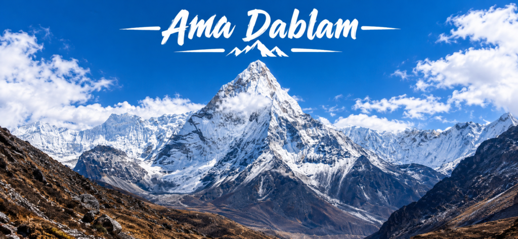
Ama Dablam stands at 6,812 metres and is widely considered one of the most beautiful mountains in the world. It dominates the visual landscape of the middle Khumbu Valley in a way that even Everest does not, because Ama Dablam’s profile is a near-perfect pyramid with a distinctive hanging glacier called the Dablam (meaning pendant or necklace in Sherpa) visible on its southwest face.
On the helicopter flight, Ama Dablam appears on the right side of the aircraft as you travel north through the Khumbu Valley. Unlike many Himalayan peaks that hide behind nearer ridges until you are almost upon them, Ama Dablam presents itself in full profile for much of the middle portion of the flight. Its southwest ridge, the standard climbing route first completed by a New Zealand and American expedition in 1961, is clearly visible from the air as a sharp rocky spine leading to the summit.
Nuptse and the Western Cwm
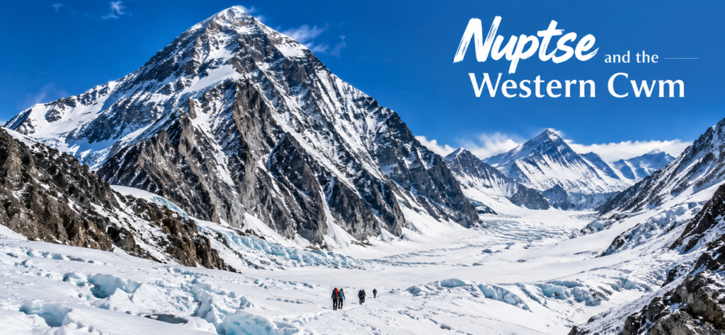
As the helicopter climbs into the upper Khumbu, Nuptse (7,861 metres) comes into view as the long, serrated west ridge that forms the south wall of what mountaineers call the Western Cwm. Cwm is a Welsh word for a glacially carved valley or hollow, and the Western Cwm is the high glacier bowl between Nuptse, Lhotse, and Everest that sits above the Khumbu Icefall.
Nuptse is often mistaken for Everest by first time visitors because it is closer and appears taller from many angles in the valley. From the helicopter, you gain a perspective that resolves this confusion: Everest sits back and above, and Nuptse forms the nearer wall that partially blocks the view from lower elevations. The full scale of the Western Cwm, roughly 3 kilometres long and 1 kilometre wide at its broadest, becomes apparent only from altitude.
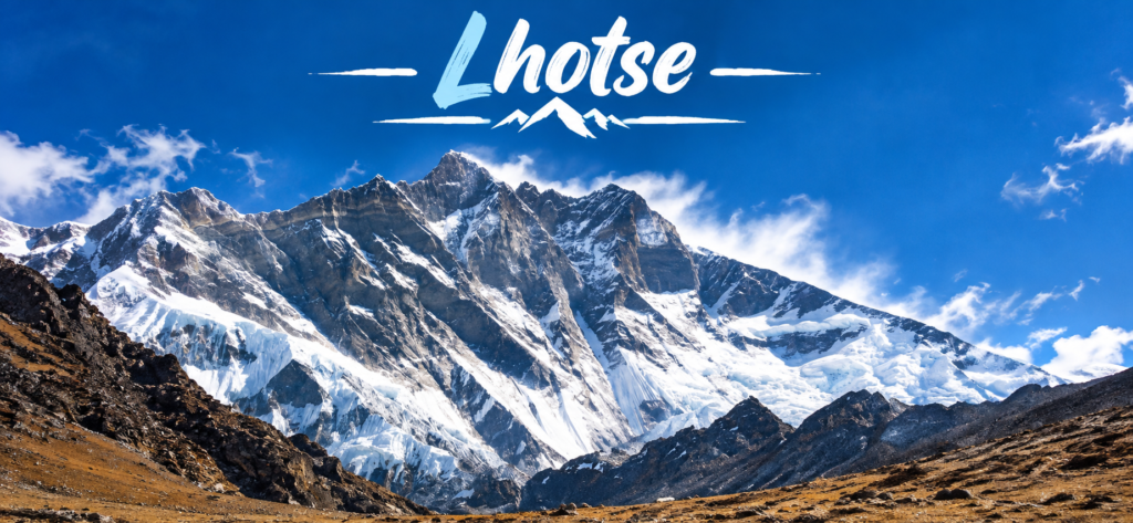
Lhotse: The Fourth Highest Mountain on Earth
Lhotse (8,516 metres) is the fourth highest mountain in the world and shares its base with Everest via the South Col, the saddle at 7,906 metres that connects the two peaks. The name means South Peak in Tibetan. From the helicopter, the Lhotse Face, a 1,000 metre wall of blue ice that forms the standard route to the South Col, is clearly visible as a steep grey-blue slope above the Western Cwm.
Lhotse’s south face (not to be confused with the Lhotse Face on the standard route) is a different feature entirely: a near vertical 3,200 metre wall that drops from the summit directly to the Imja Valley. It is the world’s largest vertical rock and ice face and, from the helicopter on the correct angle, its scale is staggering.
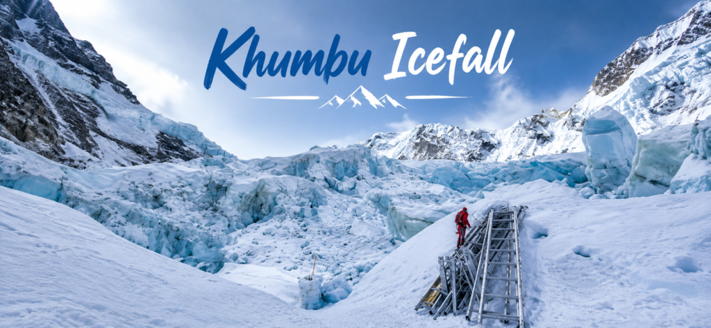
The Khumbu Icefall
The Khumbu Icefall is the most dangerous section of the standard Everest climbing route. It is a 600-metre high section of severely crevassed glacier that moves downhill at a rate of approximately one metre per day, meaning the ice is constantly shifting, collapsing, and reorganizing. Seracs (towers of ice) rise 10 to 20 metres high throughout the icefall, and climbers spend weeks moving through it in the pre dawn hours when temperatures keep the ice more stable.
From the helicopter, the Khumbu Icefall is one of the most arresting features of the entire flight. The chaotic jumble of ice blocks, the deep blue crevasses, and the scale of the thing, wider than many city blocks and taller than most buildings, is immediately obvious from above in a way that photographs from ground level struggle to communicate. You are looking down at something that kills experienced mountaineers. From inside a warm helicopter cabin, the gulf between observer and observed is worth sitting with.
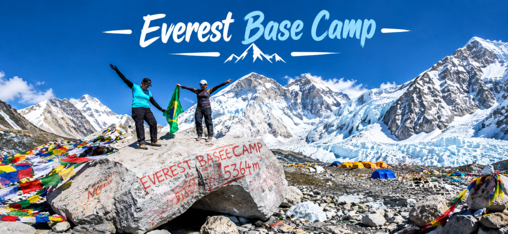
Everest Base Camp at 5,364 Metres
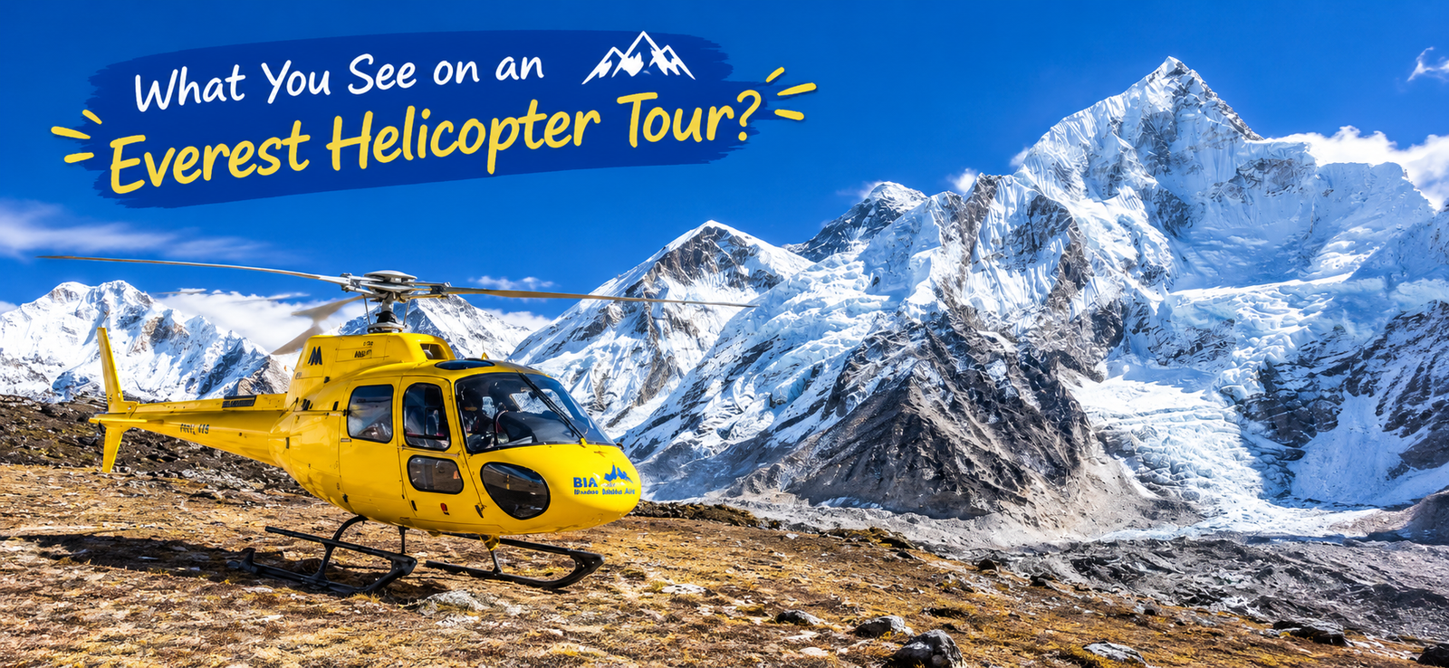
Everest Base Camp sits at 5,364 metres on the lateral moraine of the Khumbu Glacier, immediately below the Khumbu Icefall. The camp is not a permanent settlement. During the spring climbing season (March to May) and a smaller autumn window, it becomes a temporary city of expedition tents, mess tents, kitchen tents, and equipment stores, housing hundreds of climbers, Sherpas, and support staff from dozens of international expeditions simultaneously.
From the helicopter, the camp appears as a scatter of colored tents on a grey moraine plateau. The color is important context: the cheerful blues, reds, and yellows of the tent city against the monochrome rock and ice of the surrounding glacier creates a visual that reads as both improbable and deeply human. People have set up a city at 5,364 metres. It looks like exactly that from the air.
In the off-season (June to September and December to February), the camp is largely empty. Stone cairns, prayer flags strung between boulders, and the remains of previous seasons’ infrastructure are visible, but the scale is harder to read without the tents for reference.
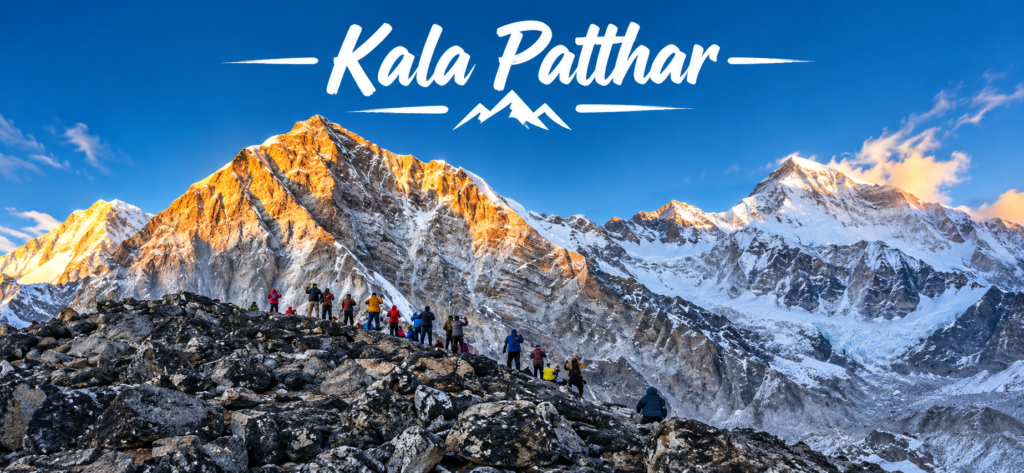
Kala Patthar at 5,644 Metres
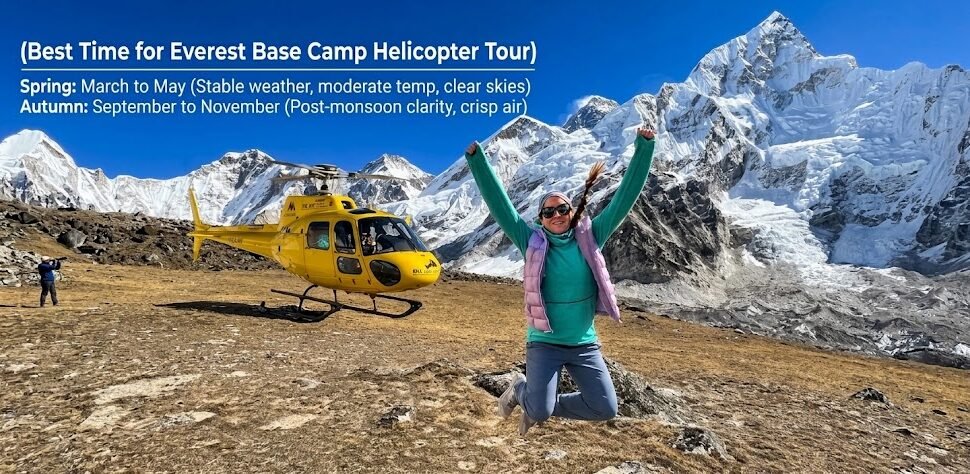
Kala Patthar is a sub-peak of Pumori, the 7,161 metre mountain that stands at the head of the Khumbu Valley on the Nepal-Tibet border. The name means black rock in Nepali, a reference to the dark schist that covers the peak. At 5,644 metres, Kala Patthar is the highest point accessible by helicopter for tourists in Nepal and is the landing point for the Kala Patthar helicopter tour.
The reason Kala Patthar is famous among trekkers, and the reason the helicopter tour includes it, is the view. From Kala Patthar, you look directly at the southwest face of Everest, the Khumbu Icefall below it, the South Col between Everest and Lhotse, and the full panorama of the Khumbu Glacier stretching south. It is, by general consensus, the best ground level view of Everest available to anyone without technical climbing skills.
From the helicopter, landing or hovering near Kala Patthar, you are at the same elevation as the peak but with 360-degree views. Pumori’s summit is directly above. The Tibet plateau is visible to the north. The entire Khumbu Valley drops away to the south. On clear days, you can identify peaks into the Rolwaling range to the west and the Makalu massif to the east.
Pumori: The Daughter Mountain
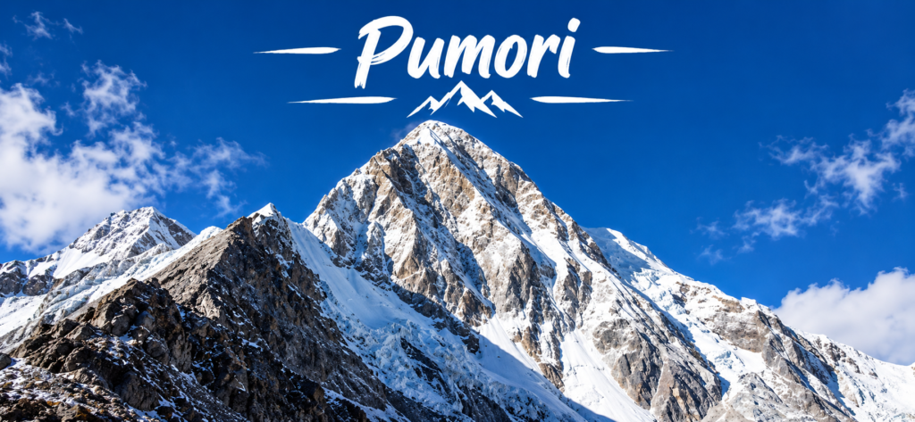
Pumori (7,161 metres) was named by George Mallory during the 1921 British reconnaissance expedition. Pumori means daughter mountain in Tibetan. It stands at the head of the Khumbu Valley immediately above Kala Patthar, and its north ridge forms one side of the glacial cirque that holds the upper Khumbu Glacier.
From the helicopter near Kala Patthar, Pumori appears directly above and behind you if you are looking south. Its southwest face is a long snow and ice slope that descends toward Kala Patthar. The summit is sharp and pyramid-shaped. Several expeditions have used Pumori’s ridge as a high camp from which to observe Everest’s upper sections, and the approach lines are visible from the helicopter on close passes.
Cho Oyu: The World’s Sixth Highest Mountain
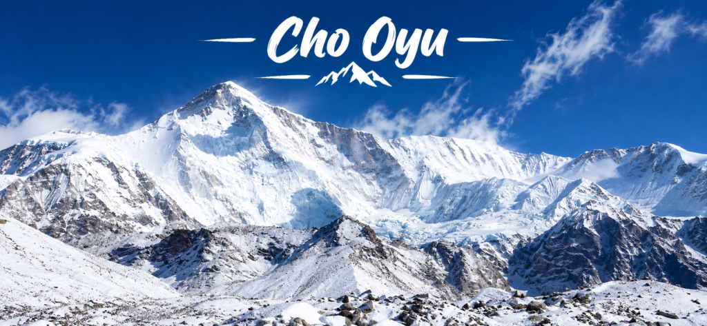
Cho Oyu (8,188 metres) is the world’s sixth highest mountain and sits on the Nepal-Tibet border approximately 20 kilometres west of Everest. On clear days from the upper Khumbu, Cho Oyu is visible as a broad, rounded summit far to the northwest. From the helicopter near Kala Patthar or flying over the Gokyo Valley, Cho Oyu dominates the western horizon.
The mountain’s name means Turquoise Goddess in Tibetan. It is considered one of the most technically straightforward of the 8,000 metre peaks, which makes it a frequent first objective for climbers building toward Everest. The standard route approaches from Tibet via the Ngojumba La pass, so the climbing infrastructure is not visible from the Nepal side, but the mountain itself is unmistakable from above.
The Ngojumba Glacier
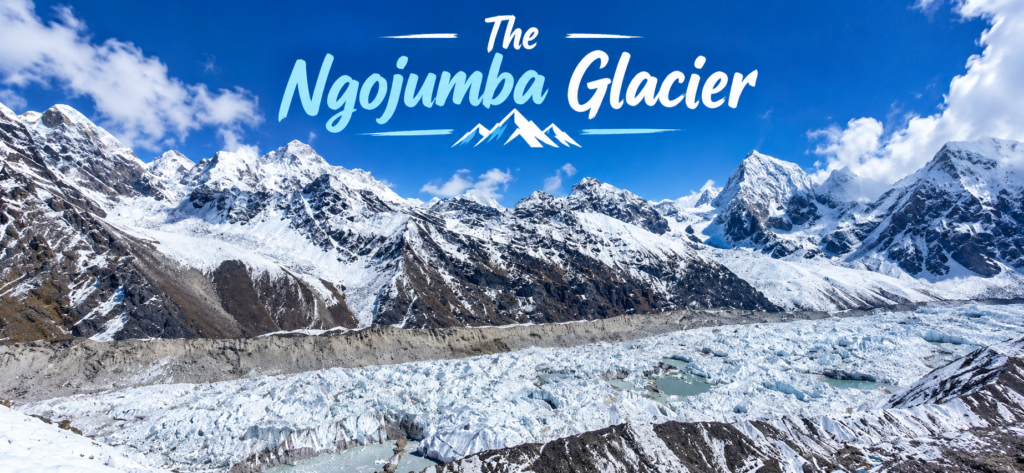
For passengers on the combined EBC and Gokyo Lakes tour, the flight crosses over or near the Ngojumba Glacier, the longest glacier in the Himalaya at approximately 36 kilometres. It flows south from Cho Oyu and terminates near the lower Gokyo Valley. From the helicopter, its scale is immediately apparent: it is wider than many rivers and stretches across the entire width of the valley floor.
Glacial features that are invisible or abstract from the ground become readable from the air. You can see the medial moraines (lines of dark rock that form where two ice flows merge), the lateral moraines (ridges of debris along the glacier’s edges), and the seracs and crevasse fields that form where the glacier bends or accelerates. The Ngojumba from the air looks exactly like what it is: a river of ice in slow motion.
What the Flight Does to Your Sense of Scale
The single most consistent thing passengers report after the Everest helicopter tour is not a specific peak or landmark but a change in their understanding of scale. The numbers you know before the flight (8,849 metres for Everest, 36 kilometres for the Ngojumba, 600 metres for the Khumbu Icefall) are abstractions until the helicopter is directly above them.
The flight resolves those abstractions into physical reality. Everest is tall in the same way that 8,849 metres is tall, not in the way a tall building is tall. The Khumbu Glacier is large in the same way that 36 kilometres of ice is large. The flight does not diminish these things. It makes them more exactly themselves than any map or photograph can.
Related reading: Everest Base Camp Helicopter Tour | Kala Patthar Landing Tour | Tour Cost Guide 2026 | What to Pack